Snæfellsjökull – the majestic ice-covered volcano has inspired many poets and writers. One of the most famous books inspired by the glacier is “Journey to the Center of the Earth” by Jules Verne. It’s here, where the magical entrance was supposed to be. Snæfellsjökull is mysterious, shrouded in legends, and an increasingly popular destination. The summit and the glacier are considered in astrology as one of the strongest chakras on Earth. (I must admit, honestly, finding out about it after some time, I can only confirm that this place has a specific aura😊).
In Arnarstapi, you can hire a guide to climb the glacier or organize a hike to the top. Among other things, on the MapsMe app, you can also find the trail’s approximate course.
However, for people with no glacier walking experience, we do not recommend climbing on their own. It may be necessary to use crampons, ice axe, rope.
Hiking Snæfellsjökull
- Distance: 8 km
- time: 4-7h (it took us 4.5h)
- total ascent: 762m
- Difficulty level: 4/5
Snæfellsjökull rises to a height of 1446 m (and its elevation is 1283 m). The 200-meter-deep volcano crater is filled with ice, flowing down its slope to form a glacier. Although the last eruption was about 1700 years ago, the volcano remains active, leaving a Háahraun lava field on the southern slope.
Due to poor weather conditions, we started our journey in the late afternoon, heading slightly to the left of the suggested route, trying to keep the edge of the dry land as long as possible. Night and morning rains and a quite high temperature (3-8 degrees Celsius) meant that we walked on melted snow rather than ice, so we didn’t use crampons at all.
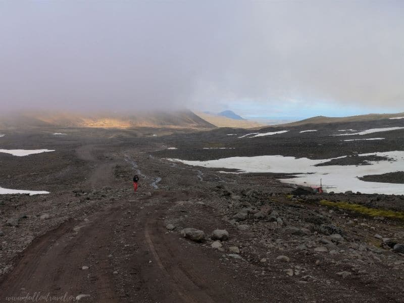
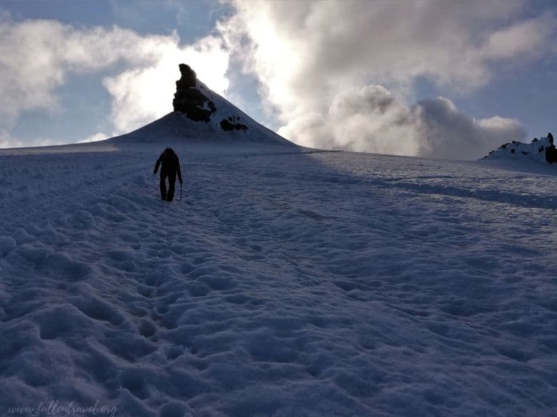
The climb was quite steep. For the next over two hours, we marched non-stop uphill. There was not a single moment of flattening. The original trail runs a bit flatter, crossing the mountainside. However, somewhere in the middle of the way, we entered the suggested, indicative approach line.
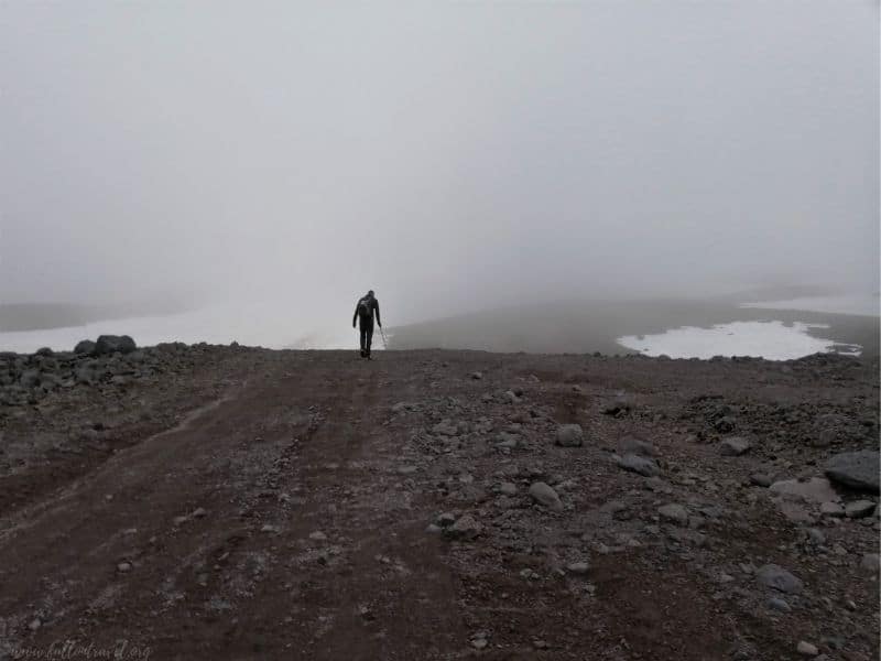
The mountain was hidden behind the clouds for a long time. Only from time to time we could see the top. It wasn’t optimistic. After my previous experience on the glacier, I was worried about the weather. Halfway, we met one person (over 70-year-old highlander from Scotland – Ian :D) heading in the same direction. We marched together for a while, which gave me a little more confidence.
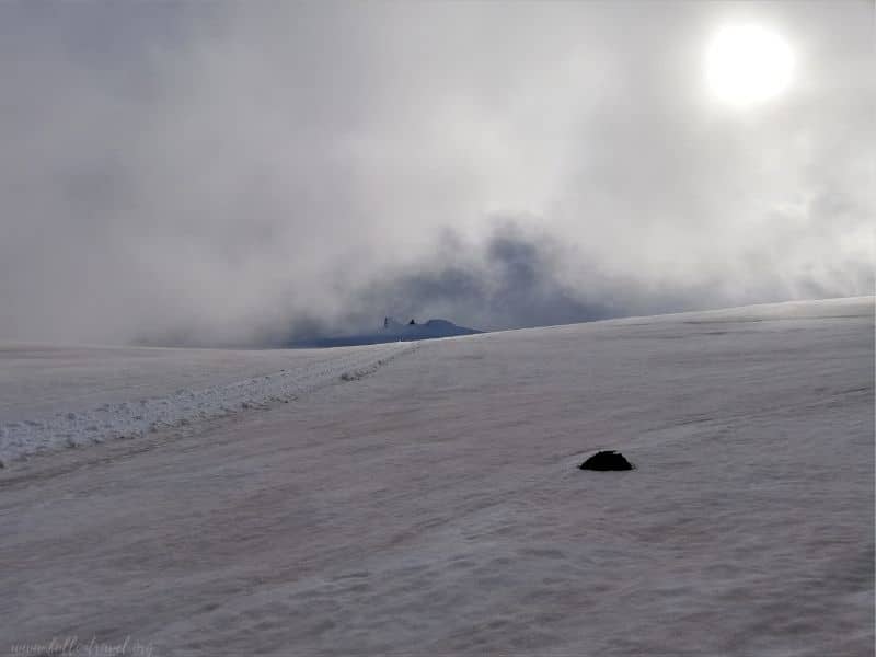
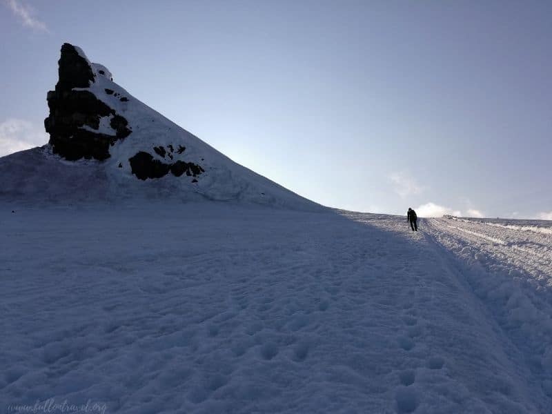
Luckily for us, the weather started to improve. The clouds we had to fight through initially also remained below, revealing a view of the southern coast of the Snaefellsnes peninsula. It was the first moment that I really felt that we were experiencing something extraordinary.
The mountain was revealing its face more and more often, as if inviting us to it, calling us this way…
In the final ascent, the sun was shining directly on us, and the mountain became even more mystic.
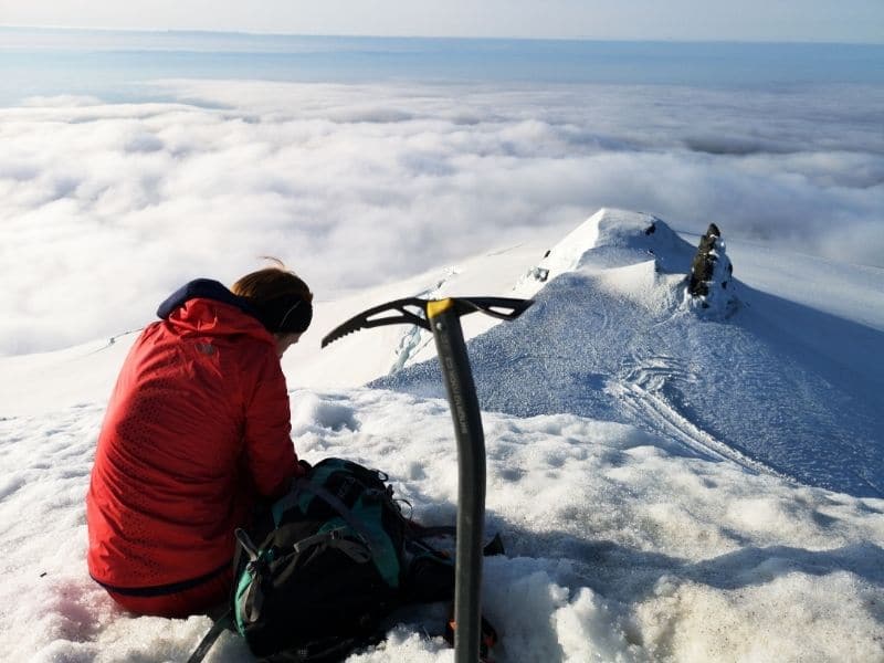
We also encountered more and more crevasses. They were large and extensive. We weren’t looking for additional attractions, and we passed them in a wide arc. We weighed every step.
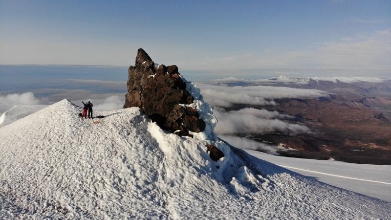
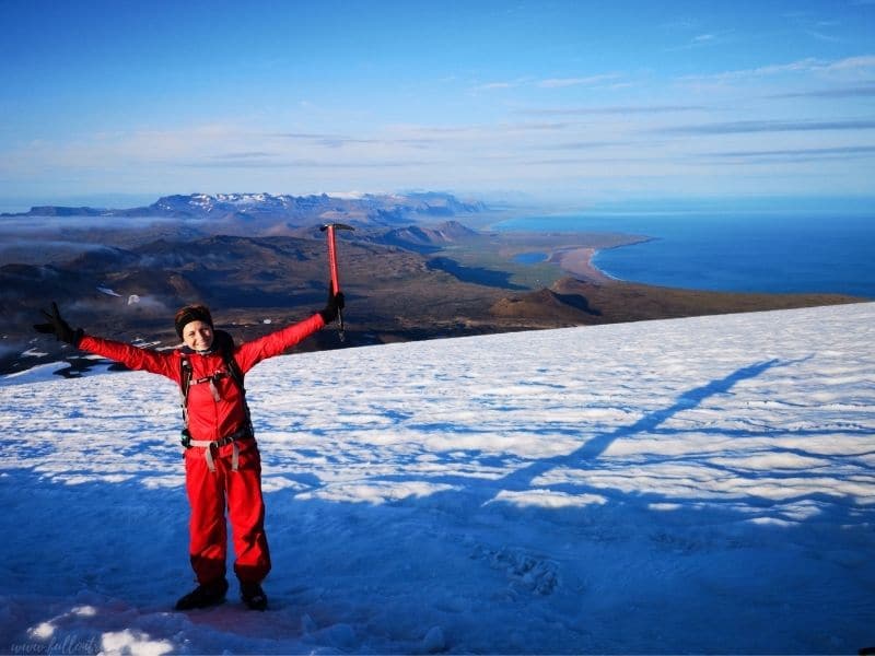
Finally, we reached an intermediate peak from where Paweł was recording videos, and I have reported our location to my loved ones. We spent some time in this place … I was staring at the crown of the top, wondering if I would be very inconsolable if I let go. I figured, yes! It looked impressive!
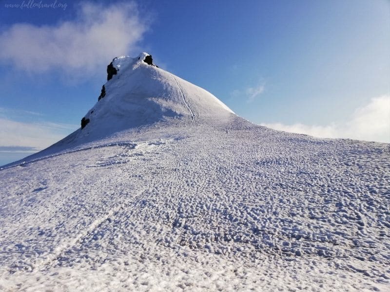
The last meters of the ascent in the melting ice was not the most pleasant. The perspective of falling on the northwestern slope cut by numerous crevasses made me want to go up and down there as quickly as possible.
Maybe it was also because Paweł was rushing me all the time while I was patiently digging the steps. However, digging gave me an (illusory) feeling safe.
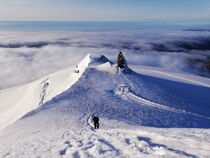
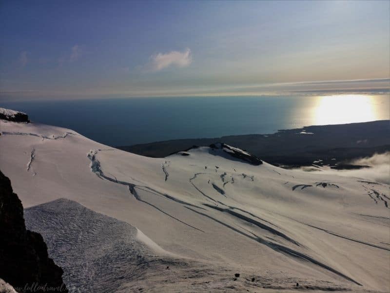
The view from the crown was amazing! These several dozen meters made a huge difference. We could admire the beautiful panorama of the peninsula, covering both the southern and northern coasts! The sky above us was cloudless. We were having a perfect view of most of the glacier. And at that moment, I realised (Paweł probably earlier) that, contrary to appearances, we tread on thin ice. We saw numerous crevasses on the northern side of the slope and around our approach.
In fear of an uncontrolled sliding to the wrong side of the peak, we put crampons on and slowly started our descent. Slightly lower, in full happiness, we were heading towards the parking lot much faster.
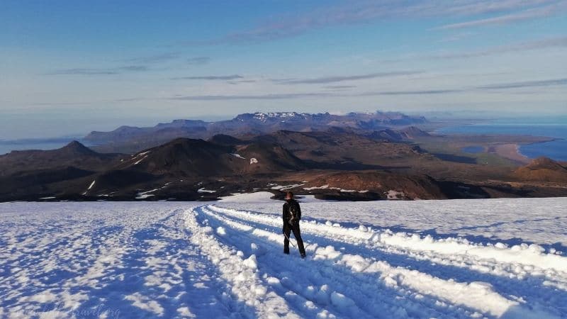
We were stepping down the same route all the time with a fabulous view of the peninsula. We got back to the car after 10 pm, after about 5 hours of including about 40-50 minutes at the very top.
The mountain let us in, and it was my best experience in Iceland!
It took us over 1 year to make a video from our hike as we couldn’t find any music that would reflect the character and emotions of this trip. But finally, it is!
We recorded this video with the ancient go pro (it still works tho!) and a few drone shots. I would like you to feel at least a little bit of what we could experience. You can also find there few words from Pawel 🙂 I hope you’ll enjoy it 🙂
Practical Information
If you are considering climbing Snafellsjokull, here is some information:
How to get there:
By car – the route from Reykjavik is about 194 km – it is best to look for accommodation in Arnarstapi
or Ólafsvík.
From both places, you can get to mountain road No. F570 Jökulshálsvegur. To inform you. The road is bumpy and quite demanding. Loose gravel with numerous blind turns and hills – only suitable for a 4×4 car. You can park on the side of the road somewhere in the middle of this road. We were looking for a place as close to the trail as possible. Here is a recommended point: open it with MAPS.ME app. We started elsewhere: https://goo.gl/maps/n5JwgUKaSojBb89S8
By bus – from Reykjavik only with a change in Borgarnes. consider whether it is profitable, the cost is about £45 one way.
What to bring with you
If you decide to hike Snæfellsjökull on your own, you may need:
- warm, waterproof clothing
- proper, waterproof hiking boots (perfectly which match to crampons)
- mountain equipment: crampons, ice axe, helmet, we recommend rope and belaying equipment
- own food
- map, GPS – We used the MAPS.ME app – with very good, detailed maps. You don’t need data to use it. Before you go to Iceland, download the map on your phone.
- camera – experience is unforgettable, but it is nice to come back to photos 🙂
- You can also choose a guided tour: I recommend this operator because we’ve been with them to Askja.
Recent Comments