Camping Landmannalaugar, located in the Fjallabak geothermal reserve, is an ideal starting point for long and short hikes. There are several loops of varying length and difficulty from the base itself.
This is also where the most popular trekking route Laugavegur runs to the Porsmork valley and even further to Skogar (80km), where has its beginning (sometimes also the end). It is mainly these two routes that attract the most walking tourists.
We managed to walk two loops in this beautiful reserve:
Brenninsteinsalda
- Distance: 10 km
- Estimated time: 2-3 hours
- Total approach: 316m
- Difficulty level: 2/5
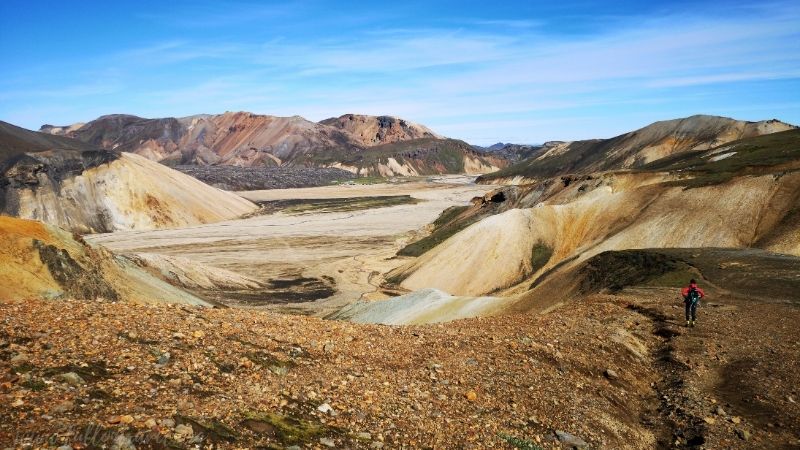
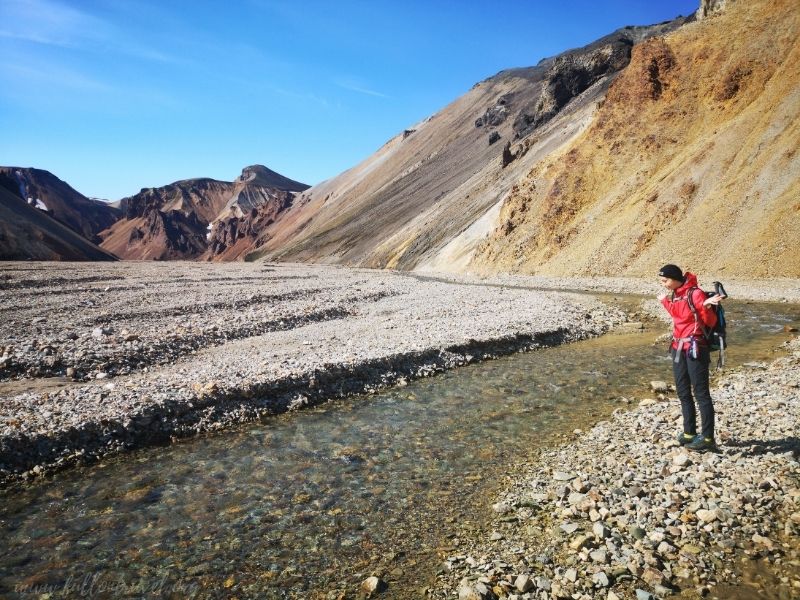
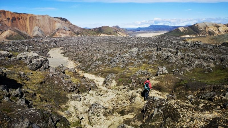
On the first day after reaching the campsite, we walked towards the Brenninsteinsald Mountain (“sulfur wave”).
This is the most popular route in the Landmannalaugar area, which is also the initial section of the Laugavegur trekking. It’s not really demanding. The trail runs through a field of sulfur fumaroles with a very nice panorama of the campsite and extensive river mites.
From the very top, there is a fabulous view of the rainbow mountains and the further part of the Laugavegur route. We walked down the western slope towards the Namiskvl River basin and then along the path below the mountain slope, along the Vondugil Valley towards the camping site.
The whole loop was about 10 km, but you can also make a shorter one by heading straight after going down towards the camping site.
Skalli
- Distance: 15 km, our loop 18.5 km
- Estimated time: 6-8 hours
- Total approach: 540 m
- Difficulty level: 3/5 (snow, navigation, route length)
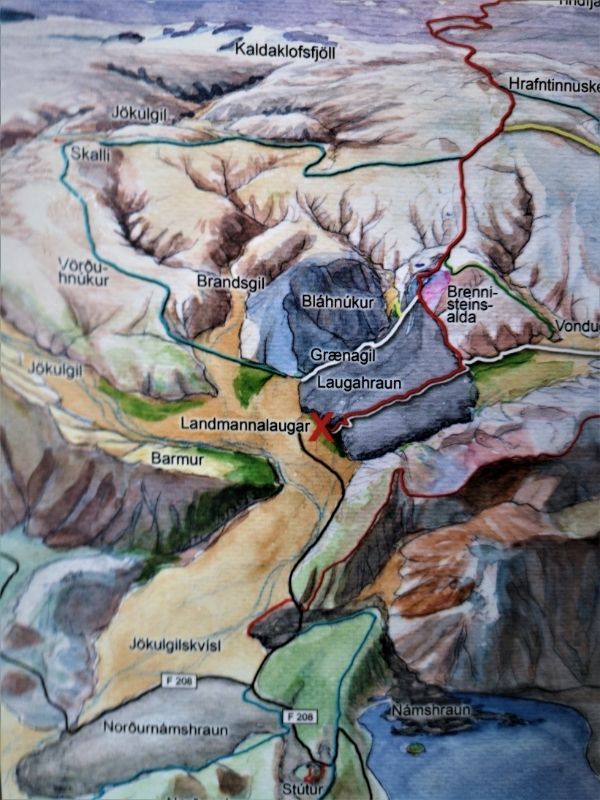
On the recommendation of the campsite staff, we went on the most beautiful route around Landmannaluagar (574m).
The trail’s name comes from the Skalli mountain (1027m), which is not really climbed, only traversed below the summit. According to the map, the loop takes about 6-8 hours of walking, and it is 15 km to cover. We have slightly extended the route in the final stage.
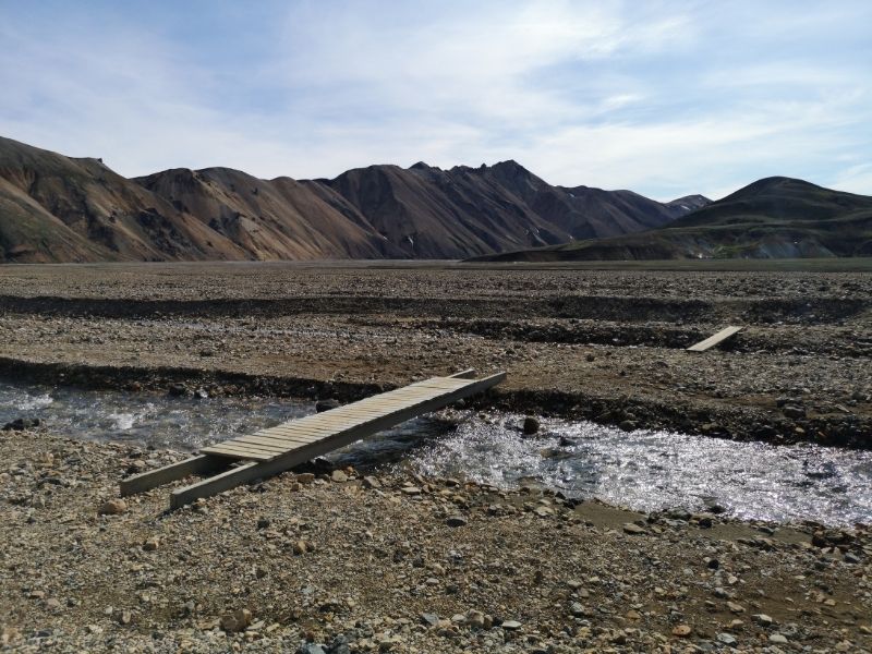
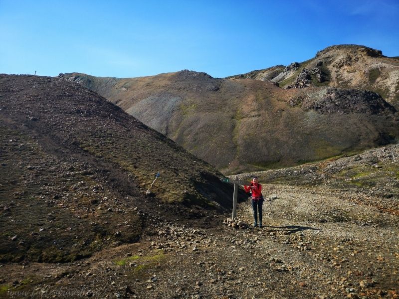
From the campsite, we’ve headed south towards the mite, jumping over small brooks. In some places, you can find footbridges or small mounds indicating the direction of the trail. After crossing the glacial tongue of Laugahran, we arrived at a sign with a marked direction of approach. (ok, I admit I misread the sign anyway and wanted to go in a completely different direction, haha). From that moment up, all the time.
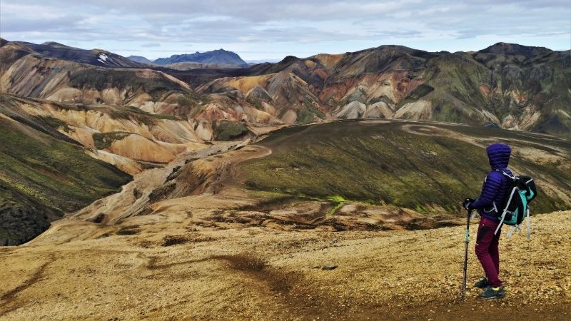
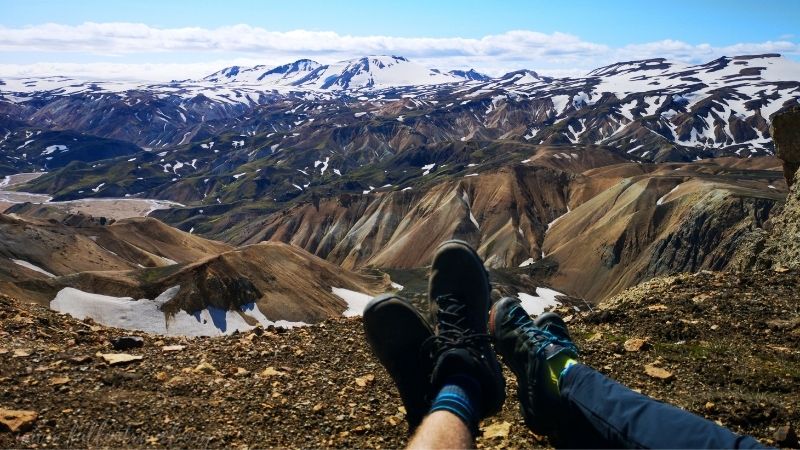
Being unable to enjoy the view sufficiently, I was constantly turning as if this landscape were to disappear. We reached a small snowy field (in August it is pretty much gone 😉), and from there, just two steps to the first summit Vörðuhnúkur! What a view!
We could admire the glacier domes, yesterday’s Brenninsteinsalda mountain, and the Blahnukur volcano (945m). From the southern side, the view extended to vast fields of craters and volcanoes painted in the colours of sand, earth, grass, sun. All this in places covered with patches of snow. Just an hour of walking behind us, and we felt as if we had already seen the most beautiful sights!
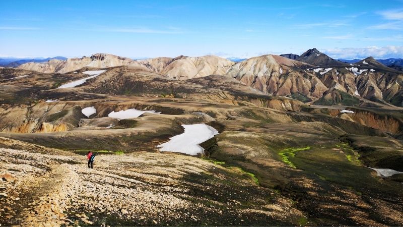
We continued our hike, hiding between successive hills and passing many streams along the way. We traversed the Skalli mountain – this section is a bit steep, and the snow was still on the slope in July – you should definitely be careful here. From above, with good visibility, you can admire the Torfajokull glacier.
After going around, the road leads gently up to a vertically sloping slope, clearly marking the Jökulgil Valley boundary directly leading to Landmannalaugar. Here we made another stop. No photo can reflect what appeared to our eyes. It was truly amazing and breathtaking. And nothing more than silence around.
After a rest, we headed down to cover the next kilometer with a widely stretched plateau. This area can be a bit difficult to navigate. Generally, the route is well marked with wooden stakes, while in the case of fog, rain, or longer persistent snow, it may be harder to see, or they may simply be under the snow. It’s worth having a GPS with you.
After reaching the intersection, we headed on the red trail towards Landmannalaugar. You can observe a large geothermal activity, ventilation holes, and rhyolite mountains glittering multi-coloured in the last fragment. We passed the Breninnsteinsalda mountain, and from here, you can follow the red trail to the campsite.
We slightly extended our loop by crossing the obsidian lava fields along the yellow Grenadil trail. Here it was like in a labirynth. The road led us to the river and then along with it to the campsite. Our route, along with the above small modification, was nearly 19 km long.
Practical information
How to get Landmannalaugar:
- By car: the easiest way to get from Keflavik is by the F208 road from the north, where there is only 30 km of gravel road. You can also go following road 26, and then road F225 – which is 47 km of off-road road. Mind, you may need to cross the river in at least two places. We have indeed seen passenger cars. I don’t recommend this route. It is recommended to drive off-road cars with a 4×4 drive.
- By bus: departures from Reykjavik. In summer, the bus to Landmnannalaugar runs daily. The best is to book in advance. The journey takes more than 4 hours. If you plan to hike in the area, I recommend taking the earliest connection.
- Organized trip: one-day trips, a departure from Reykjavik, Super Truck 4×4 Exploration, Super Jeep Tour. I won’t recommend any particular as we didn’t use this option. This is the most expensive option, but certainly worth your attention as well. You can visit more places during the trip, including the Hekla volcano – but you spend less time in Landmannalaugar.
- Accommodation: It’s worth staying in Landmannalaugar for at least one night. More information you can find here.
What to bring with you
- own food – there is a shop with basic food at the campsite, the prices are high, if you plan to spend the whole day here, it’s better to prepare your own food.
- comfortable shoes and warm, waterproof clothes – the mountains area’s temperature is lower than along the coast, and the weather changes. Check the weather forecast before you go.
- map, GPS – the terrain can be difficult to navigate if it is misty or covered with snow. We used the MAPS.ME application – with very good, detailed maps. You don’t need data to use it. Before you go to Iceland, download the map on your phone.
- –towel and swimwear – a geothermal river flows through the Landmannalaugar. There is nothing more pleasant than resting your tired legs in warm, sulfuric waters.
- –camera – the views are fabulous, you have to capture it! 😊
Recent Comments