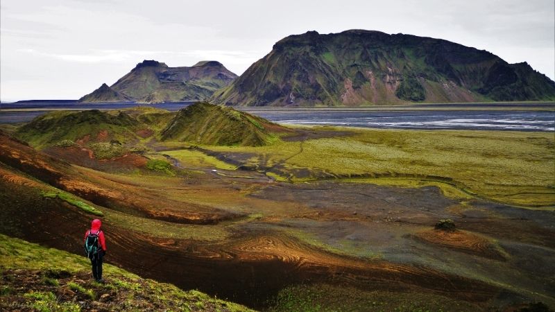
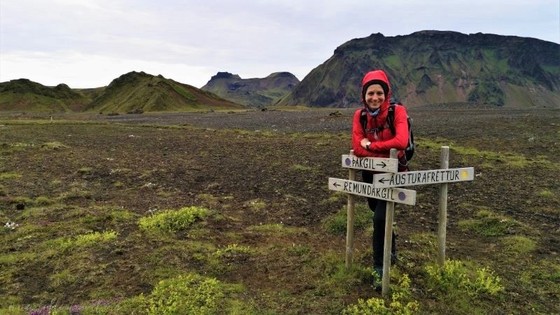
Þakgil (Thakgil) is the most underrated and most overlooked place among bloggers. I don’t know why, because it’s the most affordable one considering access by car.
If you are interested in hiking away from the crowds, with fabulous views, and you don’t have much time to go deeper into the highlands, this is the perfect place!
Thakgil – hiking:
- Distance: 9.2 km
- Estimated time: 2-4 hours
- Total approach: 313m
- Difficulty level: 2/5
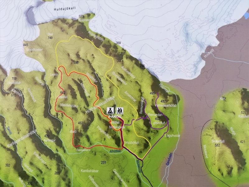
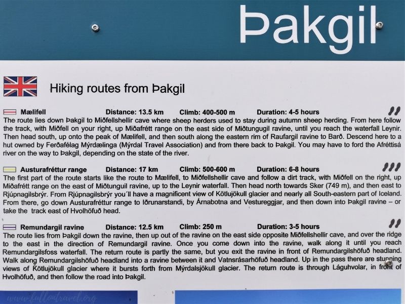
At first glance, Thakgil seems to be a small canyon with a clearing at the end – a dead end, but nothing could be more wrong! This charming place has much more to offer than just a magical accommodation base. Three hiking trails of varying lengths and difficulty depart from the campsite: 10, 14, and 17km!
You can find more details about routes on pictures below:
Due to poor weather conditions, we had to reduce hiking to a few hours due to the two days planned in advance.
Around 18:30, we set off towards the purple trail. After about 100m, the map shows to turn left and cross the river. Paweł jumped over the stream without any problems, but it was far too wide and too deep to go without getting my feet wet. I chose another place to cross the water, much closer to the campsite, but my shoes had to be removed anyway.
We reached the foot of the mountain, from where a steep path led. We were gaining height very quickly. Then we came to the intersection, where the road split in three directions: left and right onto the yellow path, and the purple trail ran more straight forward.
We continued our trip with the purple one towards the Remundargilsfoss waterfall and took a stop near this unusual waterfall, a few photos, videos, and wondered what to do next. We’re tempted to approach the waterfall after a short break, but we knew that we didn’t have enough time to return before the forecasted rainfall. We’ve decided to step back a little to the intersection and follow the yellow trail to the southwest. Thanks to this, we could look at the campsite from a completely new perspective.
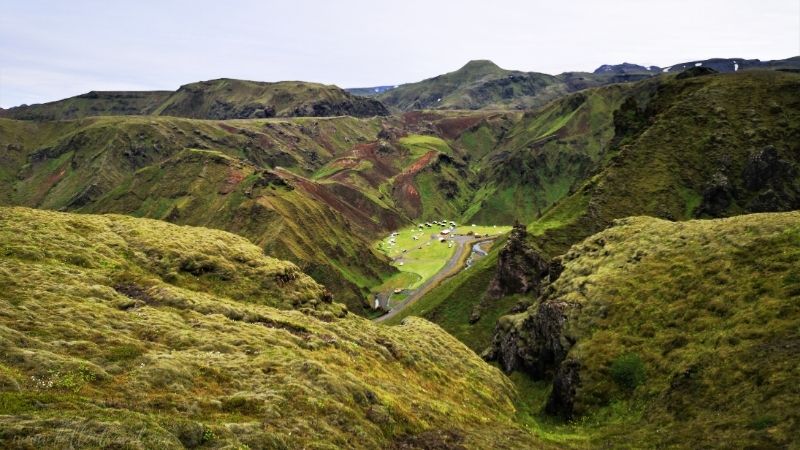
For a long time, we marched away from our base. The planned loop was longer than we expected. We went down on the completely opposite side of the gorge, crowning the trip with a fabulous view of Hafursey Mountain and the smaller Hjörleifshöfði. Once both were islands and the southernmost points of Iceland. After the eruption of the Katla volcano in 1918, it became surrounded by sandstone fields.
The descent was also quite steep. You had the impression that the rock under your legs falls perpendicularly downwards. The view, however, had more than compensated and gave us the energy to return. After about 1 km on the trail, we reached the main road leading to the campsite. The gravel road seemed to be a little longer this time, but the presence of sheep and birds made the final section much more pleasant. We returned to the camp around 22:30. The entire route was about 10 km long.
Practical tips
- How to get there:
- By car: Pakgil can be reached by departing from Vik north along the F214 road. The section takes 20 km on off-road roads, but I definitely do not recommend using a regular passenger car. The road is bumpy and winding. You can lose your chassis. 😉
- By bus: there is no direct connection to Reykjavik. You can get a bus to Vik, from there you can take a taxi, but the prices are very high.
- Accommodation: find more information about Thakgil here! Let me just say that it was our best camping! 😊
Recent Comments